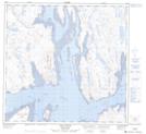
Maps showing Îles Radisson, Rivière-Koksoak; Kativik, Quebec
Îles Radisson is a Island located in Rivière-Koksoak; Kativik, Quebec and has an elevation of 2 meters.
- Latitude: 58° 44' 20'' North (decimal: 58.7387955)
- Longitude: 69° 41' 17'' West (decimal: -69.6881746)
- Topography Feature Category: Island
- Geographical Feature: Îles / Iles
- Canadian Province/Territory: Quebec
- Elevation: 2 meters
- Location: Rivière-Koksoak; Kativik
- Atlas of Canada Locator Map: Îles Radisson
- GPS Coordinate Locator Map: Îles Radisson Lat/Long
Îles Radisson NTS Map Sheets