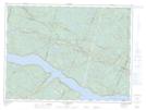
Maps showing Rivière Sainte-Marguerite, Sacré-C¿ur; La Haute-Côte-Nord, Quebec
Rivière Sainte-Marguerite is a River located in Sacré-C¿ur; La Haute-Côte-Nord, Quebec and has an elevation of 138 meters.
- Latitude: 48° 15' 47'' North (decimal: 48.2630790)
- Longitude: 69° 56' 44'' West (decimal: -69.9456130)
- Topography Feature Category: River
- Geographical Feature: Rivière
- Canadian Province/Territory: Quebec
- Elevation: 138 meters
- Location: Sacré-C¿ur; La Haute-Côte-Nord
- Atlas of Canada Locator Map: Rivière Sainte-Marguerite
- GPS Coordinate Locator Map: Rivière Sainte-Marguerite Lat/Long
Rivière Sainte-Marguerite NTS Map Sheets