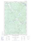
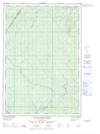
Maps showing Rivière Saint-François, Rivière-Bleue; Témiscouata, Quebec
Rivière Saint-François is a River located in Rivière-Bleue; Témiscouata, Quebec and has an elevation of 198 meters.
- Latitude: 47° 17' 59'' North (decimal: 47.2997425)
- Longitude: 69° 3' 4'' West (decimal: -69.0511457)
- Topography Feature Category: River
- Geographical Feature: Rivière
- Canadian Province/Territory: Quebec
- Elevation: 198 meters
- Location: Rivière-Bleue; Témiscouata
- Atlas of Canada Locator Map: Rivière Saint-François
- GPS Coordinate Locator Map: Rivière Saint-François Lat/Long
Rivière Saint-François NTS Map Sheets