Maps showing Lac Santein, Gros-Mécatina; Basse-Côte-Nord, Quebec
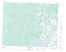
Lac Santein is a Lake located in Gros-Mécatina; Basse-Côte-Nord, Quebec and has an elevation of 76 meters.
- Latitude: 51° 5' 35'' North (decimal: 51.0931177)
- Longitude: 59° 3' 53'' West (decimal: -59.0646752)
- Topography Feature Category: Lake
- Geographical Feature: Lac
- Canadian Province/Territory: Quebec
- Elevation: 76 meters
- Location: Gros-Mécatina; Basse-Côte-Nord
- Atlas of Canada Locator Map: Lac Santein
- GPS Coordinate Locator Map: Lac Santein Lat/Long
Lac Santein NTS Map Sheets