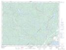
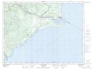
Maps showing Lac Sarah, Colombier; La Haute-Côte-Nord, Quebec
Lac Sarah is a Lake located in Colombier; La Haute-Côte-Nord, Quebec and has an elevation of 125 meters.
- Latitude: 48° 52' 21'' North (decimal: 48.8725)
- Longitude: 68° 59' 58'' West (decimal: -68.9994444)
- Topography Feature Category: Lake
- Geographical Feature: Lac
- Canadian Province/Territory: Quebec
- Elevation: 125 meters
- Location: Colombier; La Haute-Côte-Nord
- Atlas of Canada Locator Map: Lac Sarah
- GPS Coordinate Locator Map: Lac Sarah Lat/Long
Lac Sarah NTS Map Sheets