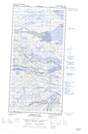
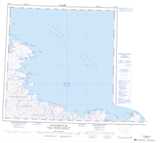
Maps showing Mont Sarriuq, Rivière-Koksoak; Kativik, Quebec
Mont Sarriuq is a Mountain located in Rivière-Koksoak; Kativik, Quebec.
- Latitude: 61° 15' 51'' North (decimal: 61.2643033)
- Longitude: 71° 44' 18'' West (decimal: -71.7383021)
- Topography Feature Category: Mountain
- Geographical Feature: Mont
- Canadian Province/Territory: Quebec
- Location: Rivière-Koksoak; Kativik
- Atlas of Canada Locator Map: Mont Sarriuq
- GPS Coordinate Locator Map: Mont Sarriuq Lat/Long
Mont Sarriuq NTS Map Sheets