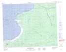
Maps showing Colline Sherrick, Baie-James; Jamésie, Quebec
Colline Sherrick is a Mountain located in Baie-James; Jamésie, Quebec and has an elevation of 82 meters.
- Latitude: 51° 46' 6'' North (decimal: 51.7683333)
- Longitude: 78° 57' 50'' West (decimal: -78.9638889)
- Topography Feature Category: Mountain
- Geographical Feature: Colline
- Canadian Province/Territory: Quebec
- Elevation: 82 meters
- Location: Baie-James; Jamésie
- Atlas of Canada Locator Map: Colline Sherrick
- GPS Coordinate Locator Map: Colline Sherrick Lat/Long
Colline Sherrick NTS Map Sheets