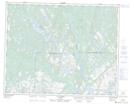
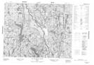
Maps showing Lac Shutler, Petit-Mécatina; Minganie, Quebec
Lac Shutler is a Lake located in Petit-Mécatina; Minganie, Quebec and has an elevation of 126 meters.
- Latitude: 51° 31' 15'' North (decimal: 51.5208951)
- Longitude: 58° 45' 56'' West (decimal: -58.7654862)
- Topography Feature Category: Lake
- Geographical Feature: Lac
- Canadian Province/Territory: Quebec
- Elevation: 126 meters
- Location: Petit-Mécatina; Minganie
- Atlas of Canada Locator Map: Lac Shutler
- GPS Coordinate Locator Map: Lac Shutler Lat/Long
Lac Shutler NTS Map Sheets