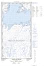
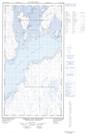
Maps showing Îles Smoky, Rivière-Koksoak; Kativik, Quebec
Îles Smoky is a Island located in Rivière-Koksoak; Kativik, Quebec and has an elevation of 1 meters.
- Latitude: 58° 56' 15'' North (decimal: 58.9373977)
- Longitude: 69° 15' 55'' West (decimal: -69.2653830)
- Topography Feature Category: Island
- Geographical Feature: Îles / Iles
- Canadian Province/Territory: Quebec
- Elevation: 1 meters
- Location: Rivière-Koksoak; Kativik
- Atlas of Canada Locator Map: Îles Smoky
- GPS Coordinate Locator Map: Îles Smoky Lat/Long
Îles Smoky NTS Map Sheets