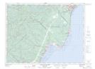
Maps showing Îlot Sore Foot, Forestville; La Haute-Côte-Nord, Quebec
Îlot Sore Foot is a Island located in Forestville; La Haute-Côte-Nord, Quebec.
- Latitude: 48° 42' 29'' North (decimal: 48.7080853)
- Longitude: 69° 4' 24'' West (decimal: -69.0733820)
- Topography Feature Category: Island
- Geographical Feature: Île / Ile
- Canadian Province/Territory: Quebec
- Location: Forestville; La Haute-Côte-Nord
- GPS Coordinate Locator Map: Îlot Sore Foot Lat/Long
Îlot Sore Foot NTS Map Sheets