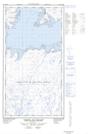
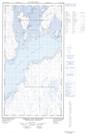
Maps showing Pointe Spur, Rivière-Koksoak; Kativik, Quebec
Pointe Spur is a Cape located in Rivière-Koksoak; Kativik, Quebec and has an elevation of 1 meters.
- Latitude: 58° 47' 57'' North (decimal: 58.7990683)
- Longitude: 69° 28' 20'' West (decimal: -69.4723379)
- Topography Feature Category: Cape
- Geographical Feature: Pointe
- Canadian Province/Territory: Quebec
- Elevation: 1 meters
- Location: Rivière-Koksoak; Kativik
- Atlas of Canada Locator Map: Pointe Spur
- GPS Coordinate Locator Map: Pointe Spur Lat/Long
Pointe Spur NTS Map Sheets