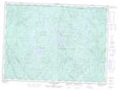
Maps showing Rivière Talayarde, Saint-Raymond; Portneuf, Quebec
Rivière Talayarde is a River located in Saint-Raymond; Portneuf, Quebec and has an elevation of 247 meters.
- Latitude: 46° 59' 40'' North (decimal: 46.9944656)
- Longitude: 71° 44' 45'' West (decimal: -71.7459320)
- Topography Feature Category: River
- Geographical Feature: Rivière
- Canadian Province/Territory: Quebec
- Elevation: 247 meters
- Location: Saint-Raymond; Portneuf
- Atlas of Canada Locator Map: Rivière Talayarde
- GPS Coordinate Locator Map: Rivière Talayarde Lat/Long
Rivière Talayarde NTS Map Sheets