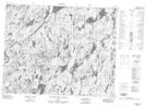
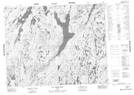
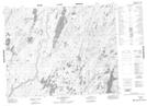
Maps showing Petit lac Témiscamie, Baie-James; Jamésie, Quebec
Petit lac Témiscamie is a Lake located in Baie-James; Jamésie, Quebec and has an elevation of 452 meters.
- Latitude: 51° 15' 6'' North (decimal: 51.2516667)
- Longitude: 72° 2' 42'' West (decimal: -72.045)
- Topography Feature Category: Lake
- Geographical Feature: Lac
- Canadian Province/Territory: Quebec
- Elevation: 452 meters
- Location: Baie-James; Jamésie
- Atlas of Canada Locator Map: Petit lac Témiscamie
- GPS Coordinate Locator Map: Petit lac Témiscamie Lat/Long
Petit lac Témiscamie NTS Map Sheets