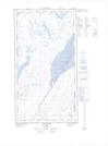
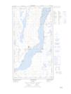
Maps showing Umingmaqautik, Kuujjuaq; Kativik, Quebec
Umingmaqautik is a Unincorporated area located in Kuujjuaq; Kativik, Quebec.
- Latitude: 58° 8' 48'' North (decimal: 58.1465423)
- Longitude: 68° 17' 55'' West (decimal: -68.2986815)
- Topography Feature Category: Unincorporated area
- Geographical Feature: Lieu-dit
- Canadian Province/Territory: Quebec
- Location: Kuujjuaq; Kativik
- Atlas of Canada Locator Map: Umingmaqautik
- GPS Coordinate Locator Map: Umingmaqautik Lat/Long
Umingmaqautik NTS Map Sheets