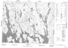
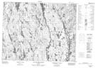
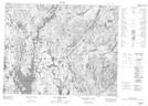
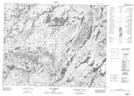
Maps showing Rivière Wabscochio, Mont-Valin; Le Fjord-du-Saguenay, Quebec
Rivière Wabscochio is a River located in Mont-Valin; Le Fjord-du-Saguenay, Quebec.
- Latitude: 50° 48' 23'' North (decimal: 50.8064690)
- Longitude: 70° 34' 0'' West (decimal: -70.5667159)
- Topography Feature Category: River
- Geographical Feature: Rivière
- Canadian Province/Territory: Quebec
- Location: Mont-Valin; Le Fjord-du-Saguenay
- GPS Coordinate Locator Map: Rivière Wabscochio Lat/Long
Rivière Wabscochio NTS Map Sheets
022L15 Baie Bellevue Topographic Map at 1:50,000 scale
022M02 Lac Des Sept Milles Topographic Map at 1:50,000 scale
022M07 Lac Piacouadie Topographic Map at 1:50,000 scale
022M10 Lac Pambrun Topographic Map at 1:50,000 scale
022L Lac Peribonca Topographic Map at 1:250,000 scale
022M Lac Pletipi Topographic Map at 1:250,000 scale
022M02 Lac Des Sept Milles Topographic Map at 1:50,000 scale
022M07 Lac Piacouadie Topographic Map at 1:50,000 scale
022M10 Lac Pambrun Topographic Map at 1:50,000 scale
022L Lac Peribonca Topographic Map at 1:250,000 scale
022M Lac Pletipi Topographic Map at 1:250,000 scale