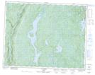
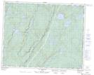
Maps showing Rivière Washa-Coush-Noon, Rivière-Nipissis; Sept-Rivières, Quebec
Rivière Washa-Coush-Noon is a River located in Rivière-Nipissis; Sept-Rivières, Quebec.
- Latitude: 50° 54' North (decimal: 50.8999999)
- Longitude: 65° 57' West (decimal: -65.9500000)
- Topography Feature Category: River
- Geographical Feature: Rivière
- Canadian Province/Territory: Quebec
- Location: Rivière-Nipissis; Sept-Rivières
- GPS Coordinate Locator Map: Rivière Washa-Coush-Noon Lat/Long
Rivière Washa-Coush-Noon NTS Map Sheets