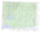
Maps showing Anse du Cormoran, Sept-Îles; Sept-Rivières, Quebec
Anse du Cormoran is a Bay located in Sept-Îles; Sept-Rivières, Quebec and has an elevation of 20 meters.
- Latitude: 50° 16' 25'' North (decimal: 50.2736111)
- Longitude: 65° 32' 53'' West (decimal: -65.5480556)
- Topography Feature Category: Bay
- Geographical Feature: Anse
- Canadian Province/Territory: Quebec
- Elevation: 20 meters
- Location: Sept-Îles; Sept-Rivières
- Atlas of Canada Locator Map: Anse du Cormoran
- GPS Coordinate Locator Map: Anse du Cormoran Lat/Long
Anse du Cormoran NTS Map Sheets