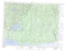
Maps showing Lacs à Ludger, Sept-Îles; Sept-Rivières, Quebec
Lacs à Ludger is a Lake located in Sept-Îles; Sept-Rivières, Quebec and has an elevation of 128 meters.
- Latitude: 50° 18' 46'' North (decimal: 50.3127778)
- Longitude: 65° 45' 43'' West (decimal: -65.7619444)
- Topography Feature Category: Lake
- Geographical Feature: Lacs
- Canadian Province/Territory: Quebec
- Elevation: 128 meters
- Location: Sept-Îles; Sept-Rivières
- Atlas of Canada Locator Map: Lacs à Ludger
- GPS Coordinate Locator Map: Lacs à Ludger Lat/Long
Lacs à Ludger NTS Map Sheets