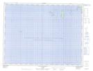
Maps showing Île de Mingan, Longue-Pointe-de-Mingan; Minganie, Quebec
Île de Mingan is a Island located in Longue-Pointe-de-Mingan; Minganie, Quebec.
- Latitude: 50° 12' 39'' North (decimal: 50.2108333)
- Longitude: 64° 7' 28'' West (decimal: -64.1244444)
- Topography Feature Category: Island
- Geographical Feature: Île / Ile
- Canadian Province/Territory: Quebec
- Location: Longue-Pointe-de-Mingan; Minganie
- GPS Coordinate Locator Map: Île de Mingan Lat/Long
Île de Mingan NTS Map Sheets