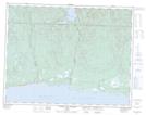
Maps showing Île au Renard, Rivière-au-Tonnerre; Minganie, Quebec
Île au Renard is a Island located in Rivière-au-Tonnerre; Minganie, Quebec and has an elevation of 89 meters.
- Latitude: 50° 19' 47'' North (decimal: 50.3297222)
- Longitude: 65° 22' 12'' West (decimal: -65.37)
- Topography Feature Category: Island
- Geographical Feature: Île / Ile
- Canadian Province/Territory: Quebec
- Elevation: 89 meters
- Location: Rivière-au-Tonnerre; Minganie
- Atlas of Canada Locator Map: Île au Renard
- GPS Coordinate Locator Map: Île au Renard Lat/Long
Île au Renard NTS Map Sheets