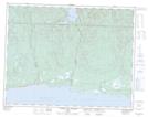
Maps showing Mornes Rouges, Rivière-au-Tonnerre; Minganie, Quebec
Mornes Rouges is a Cliff located in Rivière-au-Tonnerre; Minganie, Quebec and has an elevation of 53 meters.
- Latitude: 50° 17' 45'' North (decimal: 50.2958910)
- Longitude: 65° 25' 48'' West (decimal: -65.4299085)
- Topography Feature Category: Cliff
- Geographical Feature: Falaises
- Canadian Province/Territory: Quebec
- Elevation: 53 meters
- Location: Rivière-au-Tonnerre; Minganie
- Atlas of Canada Locator Map: Mornes Rouges
- GPS Coordinate Locator Map: Mornes Rouges Lat/Long
Mornes Rouges NTS Map Sheets