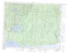
Maps showing Ruisseau Saint-Charles Ouest, Sept-Îles; Sept-Rivières, Quebec
Ruisseau Saint-Charles Ouest is a River located in Sept-Îles; Sept-Rivières, Quebec and has an elevation of 29 meters.
- Latitude: 50° 16' 8'' North (decimal: 50.2688889)
- Longitude: 65° 49' 25'' West (decimal: -65.8236111)
- Topography Feature Category: River
- Geographical Feature: Ruisseau
- Canadian Province/Territory: Quebec
- Elevation: 29 meters
- Location: Sept-Îles; Sept-Rivières
- Atlas of Canada Locator Map: Ruisseau Saint-Charles Ouest
- GPS Coordinate Locator Map: Ruisseau Saint-Charles Ouest Lat/Long
Ruisseau Saint-Charles Ouest NTS Map Sheets