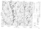
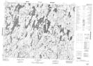
Maps showing Lac Haricot, Chute-des-Passes; Maria-Chapdelaine, Quebec
Lac Haricot is a Lake located in Chute-des-Passes; Maria-Chapdelaine, Quebec and has an elevation of 537 meters.
- Latitude: 51° 0' 18'' North (decimal: 51.005)
- Longitude: 71° 36' 37'' West (decimal: -71.6102778)
- Topography Feature Category: Lake
- Geographical Feature: Lac
- Canadian Province/Territory: Quebec
- Elevation: 537 meters
- Location: Chute-des-Passes; Maria-Chapdelaine
- Atlas of Canada Locator Map: Lac Haricot
- GPS Coordinate Locator Map: Lac Haricot Lat/Long
Lac Haricot NTS Map Sheets