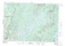
Maps showing Deuxième branche de la Rivière Eaton, Saint-Isidore-de-Clifton; Le Haut-Saint-François, Quebec
Deuxième branche de la Rivière Eaton is a River located in Saint-Isidore-de-Clifton; Le Haut-Saint-François, Quebec and has an elevation of 540 meters.
- Latitude: 45° 17' 18'' North (decimal: 45.2883770)
- Longitude: 71° 25' 23'' West (decimal: -71.4231364)
- Topography Feature Category: River
- Geographical Feature: Ruisseau
- Canadian Province/Territory: Quebec
- Elevation: 540 meters
- Location: Saint-Isidore-de-Clifton; Le Haut-Saint-François
- Atlas of Canada Locator Map: Deuxième branche de la Rivière Eaton
- GPS Coordinate Locator Map: Deuxième branche de la Rivière Eaton Lat/Long
Deuxième branche de la Rivière Eaton NTS Map Sheets