Maps showing Rivière Pontax, Baie-James; Jamésie, Quebec
Rivière Pontax is a River located in Baie-James; Jamésie, Quebec and has an elevation of 35 meters.
- Latitude: 51° 35' 55'' North (decimal: 51.5987041)
- Longitude: 78° 48' 53'' West (decimal: -78.8147011)
- Topography Feature Category: River
- Geographical Feature: Rivière
- Canadian Province/Territory: Quebec
- Elevation: 35 meters
- Location: Baie-James; Jamésie
- Atlas of Canada Locator Map: Rivière Pontax
- GPS Coordinate Locator Map: Rivière Pontax Lat/Long
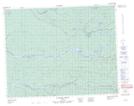
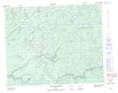
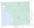
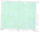
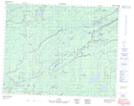
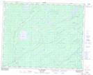
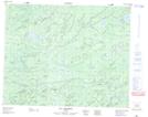
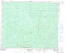
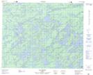
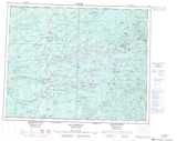
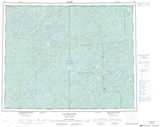
Rivière Pontax NTS Map Sheets
032M08 Colline Jaray Topographic Map at 1:50,000 scale
032M09 Colline Pontax Topographic Map at 1:50,000 scale
032M10 Pointe Du Bois Brule Topographic Map at 1:50,000 scale
032N11 Lac Boisrobert Topographic Map at 1:50,000 scale
032N12 Topographic Map at 1:50,000 scale
032N14 Lac Mirabelli Topographic Map at 1:50,000 scale
032N15 Lac Chambois Topographic Map at 1:50,000 scale
032N16 Collines Lescar Topographic Map at 1:50,000 scale
032O13 Lac Abigail Topographic Map at 1:50,000 scale
032M Fort-Rupert Topographic Map at 1:250,000 scale
032N Lac Nemiscau Topographic Map at 1:250,000 scale
032O Lac Mesgouez Topographic Map at 1:250,000 scale