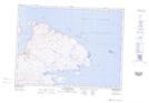
Maps showing Ruisseau Stupart, Rivière-Koksoak; Kativik, Quebec
Ruisseau Stupart is a River located in Rivière-Koksoak; Kativik, Quebec and has an elevation of 70 meters.
- Latitude: 61° 34' 19'' North (decimal: 61.5718645)
- Longitude: 71° 37' 3'' West (decimal: -71.6176004)
- Topography Feature Category: River
- Geographical Feature: Ruisseau
- Canadian Province/Territory: Quebec
- Elevation: 70 meters
- Location: Rivière-Koksoak; Kativik
- Atlas of Canada Locator Map: Ruisseau Stupart
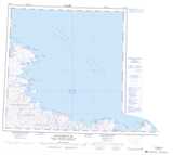
- GPS Coordinate Locator Map: Ruisseau Stupart Lat/Long
Ruisseau Stupart NTS Map Sheets