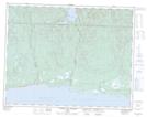
Maps showing Rivière Vibert, Lac-Jérôme; Minganie, Quebec
Rivière Vibert is a River located in Lac-Jérôme; Minganie, Quebec and has an elevation of 144 meters.
- Latitude: 50° 22' 7'' North (decimal: 50.3686111)
- Longitude: 65° 2' 39'' West (decimal: -65.0441667)
- Topography Feature Category: River
- Geographical Feature: Rivière
- Canadian Province/Territory: Quebec
- Elevation: 144 meters
- Location: Lac-Jérôme; Minganie
- Atlas of Canada Locator Map: Rivière Vibert
- GPS Coordinate Locator Map: Rivière Vibert Lat/Long
Rivière Vibert NTS Map Sheets