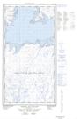
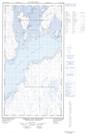
Maps showing Baie Kangirsualuk, Rivière-Koksoak; Kativik, Quebec
Baie Kangirsualuk is a Bay located in Rivière-Koksoak; Kativik, Quebec.
- Latitude: 58° 52' 45'' North (decimal: 58.8790631)
- Longitude: 68° 59' 52'' West (decimal: -68.9978774)
- Topography Feature Category: Bay
- Geographical Feature: Baie
- Canadian Province/Territory: Quebec
- Location: Rivière-Koksoak; Kativik
- Atlas of Canada Locator Map: Baie Kangirsualuk
- GPS Coordinate Locator Map: Baie Kangirsualuk Lat/Long
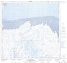
Baie Kangirsualuk NTS Map Sheets