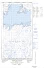
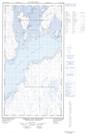
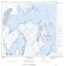
Maps showing Île Qikirtajuaq, Rivière-Koksoak; Kativik, Quebec
Île Qikirtajuaq is a Island located in Rivière-Koksoak; Kativik, Quebec.
- Latitude: 59° 3' 57'' North (decimal: 59.0657386)
- Longitude: 69° 13' 9'' West (decimal: -69.2192634)
- Topography Feature Category: Island
- Geographical Feature: Île / Ile
- Canadian Province/Territory: Quebec
- Location: Rivière-Koksoak; Kativik
- Atlas of Canada Locator Map: Île Qikirtajuaq
- GPS Coordinate Locator Map: Île Qikirtajuaq Lat/Long
Île Qikirtajuaq NTS Map Sheets