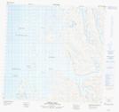
Maps showing Île Siuralik, Rivière-Koksoak; Kativik, Quebec
Île Siuralik is a Island located in Rivière-Koksoak; Kativik, Quebec.
- Latitude: 59° 9' 49'' North (decimal: 59.1636111)
- Longitude: 65° 49' 37'' West (decimal: -65.8269444)
- Topography Feature Category: Island
- Geographical Feature: Île / Ile
- Canadian Province/Territory: Quebec
- Location: Rivière-Koksoak; Kativik
- Atlas of Canada Locator Map: Île Siuralik
- GPS Coordinate Locator Map: Île Siuralik Lat/Long
Île Siuralik NTS Map Sheets