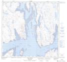
Maps showing Baie Tulagiaq, Rivière-Koksoak; Kativik, Quebec
Baie Tulagiaq is a Bay located in Rivière-Koksoak; Kativik, Quebec and has an elevation of 1 meters.
- Latitude: 58° 57' 25'' North (decimal: 58.9568543)
- Longitude: 69° 50' 13'' West (decimal: -69.8370499)
- Topography Feature Category: Bay
- Geographical Feature: Baie
- Canadian Province/Territory: Quebec
- Elevation: 1 meters
- Location: Rivière-Koksoak; Kativik
- Atlas of Canada Locator Map: Baie Tulagiaq
- GPS Coordinate Locator Map: Baie Tulagiaq Lat/Long
Baie Tulagiaq NTS Map Sheets