Maps showing Île Urpilik, Kuujjuaq; Kativik, Quebec
Île Urpilik is a Island located in Kuujjuaq; Kativik, Quebec.
- Latitude: 58° 3' 22'' North (decimal: 58.0559863)
- Longitude: 68° 26' 25'' West (decimal: -68.4403596)
- Topography Feature Category: Island
- Geographical Feature: Île / Ile
- Canadian Province/Territory: Quebec
- Location: Kuujjuaq; Kativik
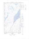
- Atlas of Canada Locator Map: Île Urpilik
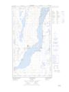
- GPS Coordinate Locator Map: Île Urpilik Lat/Long
Île Urpilik NTS Map Sheets