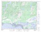
Maps showing Pointe Matsitew, Longue-Pointe-de-Mingan; Minganie, Quebec
Pointe Matsitew is a Cape located in Longue-Pointe-de-Mingan; Minganie, Quebec and has an elevation of 23 meters.
- Latitude: 50° 17' 48'' North (decimal: 50.2966667)
- Longitude: 64° 0' 8'' West (decimal: -64.0022222)
- Topography Feature Category: Cape
- Geographical Feature: Pointe
- Canadian Province/Territory: Quebec
- Elevation: 23 meters
- Location: Longue-Pointe-de-Mingan; Minganie
- Atlas of Canada Locator Map: Pointe Matsitew
- GPS Coordinate Locator Map: Pointe Matsitew Lat/Long
Pointe Matsitew NTS Map Sheets