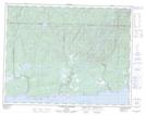
Maps showing Havre de Magpie, Rivière-Saint-Jean; Minganie, Quebec
Havre de Magpie is a Bay located in Rivière-Saint-Jean; Minganie, Quebec and has an elevation of 32 meters.
- Latitude: 50° 18' 21'' North (decimal: 50.3058333)
- Longitude: 64° 29' 55'' West (decimal: -64.4986111)
- Topography Feature Category: Bay
- Geographical Feature: Havre
- Canadian Province/Territory: Quebec
- Elevation: 32 meters
- Location: Rivière-Saint-Jean; Minganie
- Atlas of Canada Locator Map: Havre de Magpie
- GPS Coordinate Locator Map: Havre de Magpie Lat/Long
Havre de Magpie NTS Map Sheets