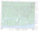
Maps showing Petite rivière au Foin, Rivière-Saint-Jean; Minganie, Quebec
Petite rivière au Foin is a River located in Rivière-Saint-Jean; Minganie, Quebec.
- Latitude: 50° 18' 52'' North (decimal: 50.3144444)
- Longitude: 64° 35' 52'' West (decimal: -64.5977778)
- Topography Feature Category: River
- Geographical Feature: Ruisseau
- Canadian Province/Territory: Quebec
- Location: Rivière-Saint-Jean; Minganie
- Atlas of Canada Locator Map: Petite rivière au Foin
- GPS Coordinate Locator Map: Petite rivière au Foin Lat/Long
Petite rivière au Foin NTS Map Sheets