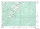
Maps showing Grande rivière Calder, Sainte-Félicité; L'Islet, Quebec
Grande rivière Calder is a River located in Sainte-Félicité; L'Islet, Quebec.
- Latitude: 46° 55' 43'' North (decimal: 46.9286332)
- Longitude: 69° 56' 12'' West (decimal: -69.9367307)
- Topography Feature Category: River
- Geographical Feature: Rivière
- Canadian Province/Territory: Quebec
- Location: Sainte-Félicité; L'Islet
- GPS Coordinate Locator Map: Grande rivière Calder Lat/Long
Grande rivière Calder NTS Map Sheets


021K Map Not Available Topographic Map at 1:250,000 scale
