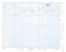
Maps showing Archipel de Mingan, Havre-Saint-Pierre; Minganie, Quebec
Archipel de Mingan is a Island located in Havre-Saint-Pierre; Minganie, Quebec.
- Latitude: 50° 12' 33'' North (decimal: 50.2091667)
- Longitude: 63° 35' 22'' West (decimal: -63.5894444)
- Topography Feature Category: Island
- Geographical Feature: Archipel
- Canadian Province/Territory: Quebec
- Location: Havre-Saint-Pierre; Minganie
- Atlas of Canada Locator Map: Archipel de Mingan
- GPS Coordinate Locator Map: Archipel de Mingan Lat/Long
Archipel de Mingan NTS Map Sheets