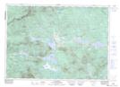
Maps showing Rivière Noire, Saint-Robert-Bellarmin; Le Granit, Quebec
Rivière Noire is a River located in Saint-Robert-Bellarmin; Le Granit, Quebec and has an elevation of 548 meters.
- Latitude: 45° 44' 26'' North (decimal: 45.7405965)
- Longitude: 70° 30' 49'' West (decimal: -70.5136796)
- Topography Feature Category: River
- Geographical Feature: Ruisseau
- Canadian Province/Territory: Quebec
- Elevation: 548 meters
- Location: Saint-Robert-Bellarmin; Le Granit
- Atlas of Canada Locator Map: Rivière Noire
- GPS Coordinate Locator Map: Rivière Noire Lat/Long
Rivière Noire NTS Map Sheets