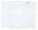
Maps showing Île aux Bouleaux, Longue-Pointe-de-Mingan; Minganie, Quebec
Île aux Bouleaux is a Island located in Longue-Pointe-de-Mingan; Minganie, Quebec and has an elevation of 0 meters.
- Latitude: 50° 14' 31'' North (decimal: 50.2420157)
- Longitude: 64° 0' 13'' West (decimal: -64.0034951)
- Topography Feature Category: Island
- Geographical Feature: Île / Ile
- Canadian Province/Territory: Quebec
- Elevation: 0 meters
- Location: Longue-Pointe-de-Mingan; Minganie
- GPS Coordinate Locator Map: Île aux Bouleaux Lat/Long
Île aux Bouleaux NTS Map Sheets