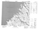
Maps showing Anse Langley, Rivière-Koksoak; Kativik, Quebec
Anse Langley is a Bay located in Rivière-Koksoak; Kativik, Quebec.
- Latitude: 59° 52' 30'' North (decimal: 59.875)
- Longitude: 65° 13' 52'' West (decimal: -65.2311111)
- Topography Feature Category: Bay
- Geographical Feature: Anse
- Canadian Province/Territory: Quebec
- Location: Rivière-Koksoak; Kativik
- Atlas of Canada Locator Map: Anse Langley
- GPS Coordinate Locator Map: Anse Langley Lat/Long
Anse Langley NTS Map Sheets