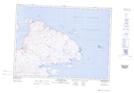
Maps showing Kangiqsujuaq, Kangiqsujuaq; Kativik, Quebec
Kangiqsujuaq is a Village located in Kangiqsujuaq; Kativik, Quebec and has an elevation of 16 meters.
- Latitude: 61° 35' 53'' North (decimal: 61.5980555)
- Longitude: 71° 57' 40'' West (decimal: -71.9611110)
- Topography Feature Category: Village
- Geographical Feature: Municipalité de village nordique
- Canadian Province/Territory: Quebec
- Elevation: 16 meters
- Location: Kangiqsujuaq; Kativik
- Atlas of Canada Locator Map: Kangiqsujuaq
- GPS Coordinate Locator Map: Kangiqsujuaq Lat/Long
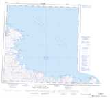
Kangiqsujuaq NTS Map Sheets