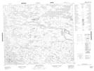
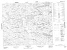
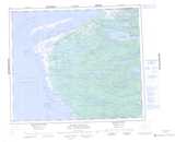
Maps showing Rivière Anistuwach, Baie-James; Jamésie, Quebec
Rivière Anistuwach is a River located in Baie-James; Jamésie, Quebec.
- Latitude: 54° 26' 6'' North (decimal: 54.435)
- Longitude: 79° 1' 0'' West (decimal: -79.0166667)
- Topography Feature Category: River
- Geographical Feature: Rivière
- Canadian Province/Territory: Quebec
- Location: Baie-James; Jamésie
- Atlas of Canada Locator Map: Rivière Anistuwach
- GPS Coordinate Locator Map: Rivière Anistuwach Lat/Long
Rivière Anistuwach NTS Map Sheets