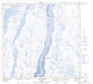
Maps showing Baie Iggiajaq, Kuujjuaq; Kativik, Quebec
Baie Iggiajaq is a Bay located in Kuujjuaq; Kativik, Quebec and has an elevation of 49 meters.
- Latitude: 58° 15' 21'' North (decimal: 58.2558333)
- Longitude: 68° 26' 23'' West (decimal: -68.4397222)
- Topography Feature Category: Bay
- Geographical Feature: Baie
- Canadian Province/Territory: Quebec
- Elevation: 49 meters
- Location: Kuujjuaq; Kativik
- Atlas of Canada Locator Map: Baie Iggiajaq
- GPS Coordinate Locator Map: Baie Iggiajaq Lat/Long
Baie Iggiajaq NTS Map Sheets