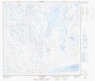
Maps showing Ikualavik, Rivière-Koksoak; Kativik, Quebec
Ikualavik is a Unincorporated area located in Rivière-Koksoak; Kativik, Quebec.
- Latitude: 58° 1' 10'' North (decimal: 58.0194444)
- Longitude: 68° 38' 54'' West (decimal: -68.6483333)
- Topography Feature Category: Unincorporated area
- Geographical Feature: Lieu-dit
- Canadian Province/Territory: Quebec
- Location: Rivière-Koksoak; Kativik
- Atlas of Canada Locator Map: Ikualavik
- GPS Coordinate Locator Map: Ikualavik Lat/Long
Ikualavik NTS Map Sheets