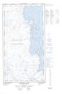
Maps showing Baie Kangirsinialuk, Rivière-Koksoak; Kativik, Quebec
Baie Kangirsinialuk is a Bay located in Rivière-Koksoak; Kativik, Quebec.
- Latitude: 58° 32' 16'' North (decimal: 58.5377778)
- Longitude: 68° 3' 47'' West (decimal: -68.0630556)
- Topography Feature Category: Bay
- Geographical Feature: Baie
- Canadian Province/Territory: Quebec
- Location: Rivière-Koksoak; Kativik
- Atlas of Canada Locator Map: Baie Kangirsinialuk
- GPS Coordinate Locator Map: Baie Kangirsinialuk Lat/Long
Baie Kangirsinialuk NTS Map Sheets