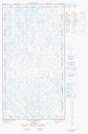
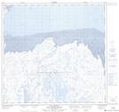
Maps showing Lac Nutillilik, Rivière-Koksoak; Kativik, Quebec
Lac Nutillilik is a Lake located in Rivière-Koksoak; Kativik, Quebec and has an elevation of 84 meters.
- Latitude: 58° 45' 57'' North (decimal: 58.7658333)
- Longitude: 68° 53' 14'' West (decimal: -68.8872221)
- Topography Feature Category: Lake
- Geographical Feature: Lac
- Canadian Province/Territory: Quebec
- Elevation: 84 meters
- Location: Rivière-Koksoak; Kativik
- Atlas of Canada Locator Map: Lac Nutillilik
- GPS Coordinate Locator Map: Lac Nutillilik Lat/Long
Lac Nutillilik NTS Map Sheets