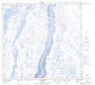
Maps showing Île Pakkivik, Kuujjuaq; Kativik, Quebec
Île Pakkivik is a Island located in Kuujjuaq; Kativik, Quebec and has an elevation of 0 meters.
- Latitude: 58° 15' 40'' North (decimal: 58.2611111)
- Longitude: 68° 16' 10'' West (decimal: -68.2694444)
- Topography Feature Category: Island
- Geographical Feature: Île / Ile
- Canadian Province/Territory: Quebec
- Elevation: 0 meters
- Location: Kuujjuaq; Kativik
- Atlas of Canada Locator Map: Île Pakkivik
- GPS Coordinate Locator Map: Île Pakkivik Lat/Long
Île Pakkivik NTS Map Sheets