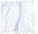
Maps showing Île Qanirqutuulik, Rivière-Koksoak; Kativik, Quebec
Île Qanirqutuulik is a Island located in Rivière-Koksoak; Kativik, Quebec and has an elevation of 0 meters.
- Latitude: 58° 25' 37'' North (decimal: 58.4269444)
- Longitude: 68° 12' 1'' West (decimal: -68.2002777)
- Topography Feature Category: Island
- Geographical Feature: Île / Ile
- Canadian Province/Territory: Quebec
- Elevation: 0 meters
- Location: Rivière-Koksoak; Kativik
- Atlas of Canada Locator Map: Île Qanirqutuulik
- GPS Coordinate Locator Map: Île Qanirqutuulik Lat/Long
Île Qanirqutuulik NTS Map Sheets