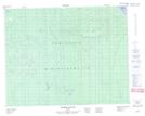
Maps showing Ruisseau Isaya Katakushihch, Baie-James; Jamésie, Quebec
Ruisseau Isaya Katakushihch is a River located in Baie-James; Jamésie, Quebec.
- Latitude: 51° 25' 46'' North (decimal: 51.4294444)
- Longitude: 79° 3' 40'' West (decimal: -79.0611111)
- Topography Feature Category: River
- Geographical Feature: Ruisseau
- Canadian Province/Territory: Quebec
- Location: Baie-James; Jamésie
- Atlas of Canada Locator Map: Ruisseau Isaya Katakushihch
- GPS Coordinate Locator Map: Ruisseau Isaya Katakushihch Lat/Long
Ruisseau Isaya Katakushihch NTS Map Sheets