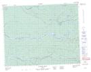
Maps showing Île Iskwashimwakunan, Baie-James; Jamésie, Quebec
Île Iskwashimwakunan is a Island located in Baie-James; Jamésie, Quebec.
- Latitude: 51° 21' 51'' North (decimal: 51.3641667)
- Longitude: 78° 20' 45'' West (decimal: -78.3458333)
- Topography Feature Category: Island
- Geographical Feature: Île / Ile
- Canadian Province/Territory: Quebec
- Location: Baie-James; Jamésie
- Atlas of Canada Locator Map: Île Iskwashimwakunan
- GPS Coordinate Locator Map: Île Iskwashimwakunan Lat/Long
Île Iskwashimwakunan NTS Map Sheets